
Jinggang Mountains Nature Reserve topographic map
Interactive map
Click on the map to display elevation.
About this map
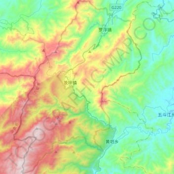
Name: Jinggang Mountains Nature Reserve topographic map, elevation, terrain.
Average elevation: 749 m
Minimum elevation: 209 m
Maximum elevation: 1,816 m
The range lies at the junction of four counties - Ninggang, Yongxing, Suichuan and Lingxian. The mountains cover some 670 km2 (260 sq mi), with an average elevation of 381.5 metres (1,252 ft) above sea level. The highest point is 2,120 m (6,960 ft) above sea level.