
Isla topographic map
Interactive map
Click on the map to display elevation.
About this map
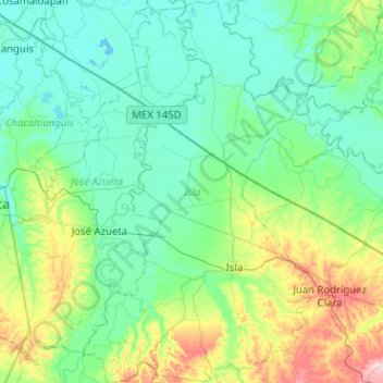
Name: Isla topographic map, elevation, terrain.
Location: Isla, Veracruz, Mexique (17.88147 -95.72937 18.36425 -95.38015)
Average elevation: 41 m
Minimum elevation: -1 m
Maximum elevation: 210 m