
Teluk Datai topographic map
Interactive map
Click on the map to display elevation.
About this map
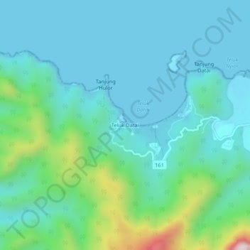
Name: Teluk Datai topographic map, elevation, terrain.
Location: Teluk Datai, Langkawi, Kedah, Malaysia (6.40620 99.64561 6.44620 99.68561)
Average elevation: 117 m
Minimum elevation: 0 m
Maximum elevation: 632 m