
Union Township topographic map
Interactive map
Click on the map to display elevation.
About this map
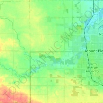
Name: Union Township topographic map, elevation, terrain.
Location: Union Township, Isabella County, Michigan, United States (43.55326 -84.84852 43.64061 -84.72736)
Average elevation: 247 m
Minimum elevation: 224 m
Maximum elevation: 291 m
Other topographic maps
Click on a map to view its topography, its elevation and its terrain.
Rosebush
United States > Michigan > Isabella County
Rosebush, Isabella Township, Isabella County, Michigan, 48878, United States
Average elevation: 236 m
Mount Pleasant
United States > Michigan > Isabella County
Mount Pleasant, Isabella County, Michigan, United States
Average elevation: 237 m