
Thank you for supporting this site ❤️
Make a donation
Make a donation
Gear up for your next adventure:
As an Amazon Associate, this site earns from qualifying purchases at no extra cost to you.
Portland topographic map
Click on the map to display elevation.
Thank you for supporting this site ❤️
Make a donation
Make a donation
Gear up for your next adventure:
As an Amazon Associate, this site earns from qualifying purchases at no extra cost to you.
About this map
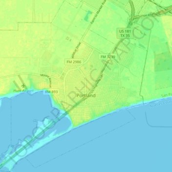
Name: Portland topographic map, elevation, terrain.
Location: Portland, San Patricio County, Texas, 78374, United States (27.84989 -97.36782 27.92135 -97.29008)
Average elevation: 7 m
Minimum elevation: -1 m
Maximum elevation: 16 m
Thank you for supporting this site ❤️
Make a donation
Make a donation
Gear up for your next adventure:
As an Amazon Associate, this site earns from qualifying purchases at no extra cost to you.
Other topographic maps
Click on a map to view its topography, its elevation and its terrain.
Garza-4th-6th Streets Colonia
United States > Texas > San Patricio County > Ingleside
Average elevation: 7 m