
L'Église de Cros topographic map
Interactive map
Click on the map to display elevation.
About this map
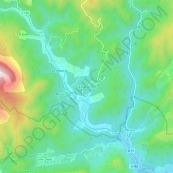
Name: L'Église de Cros topographic map, elevation, terrain.
Average elevation: 329 m
Minimum elevation: 164 m
Maximum elevation: 747 m
Other topographic maps
Click on a map to view its topography, its elevation and its terrain.
La Rouvière
France > Occitanie > Gard > Cros
La Rouvière, Cros, Le Vigan, Gard, Occitanie, France métropolitaine, 30170, France
Average elevation: 580 m
La Pieuzelle
France > Occitanie > Gard > Cros
La Pieuzelle, Cros, Le Vigan, Gard, Occitanie, France métropolitaine, 30170, France
Average elevation: 369 m