
Gamaliel topographic map
Interactive map
Click on the map to display elevation.
About this map
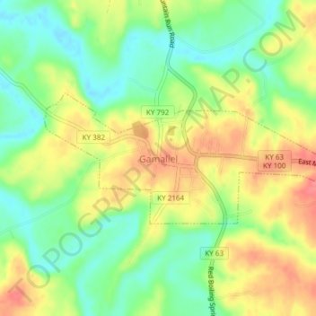
Name: Gamaliel topographic map, elevation, terrain.
Location: Gamaliel, Monroe County, Kentucky, Estados Unidos (36.63355 -85.81026 36.64605 -85.77268)
Average elevation: 233 m
Minimum elevation: 200 m
Maximum elevation: 269 m