Geolocate

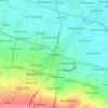
Sooko topographic map

Click on the map to display elevation.

About this map

Name: Sooko topographic map, elevation, terrain.

Location: Sooko, Mojokerto, East Java, Java, Indonesia (-7.49909 112.42134 -7.48048 112.43524)

Average elevation: 27 m

Minimum elevation: 22 m

Maximum elevation: 32 m

Other topographic maps

Click on a map to view its topography, its elevation and its terrain.
Jatirejo

Indonesia > East Java > Mojokerto > Gading

Average elevation: 82 m

Mojosari

Indonesia > East Java > Mojokerto > Wonokusumo

Average elevation: 34 m

Sooko

Indonesia > East Java > Mojokerto > Gemekan

Average elevation: 39 m

Gear up for your next adventure:

🎒Replacement Sternum Straps - Repair parts for hiking rucksacks
🧼Technical Clothing Wash - Special soap to clean and restore waterproof membranes
🔋Solar Power Banks - Keep your GPS and phone charged during multi-day expeditions
🥾Men's Waterproof Hiking Boots - Durable footwear with deep lugs for muddy and rocky UK terrains
🥤Hydration Bladders - Hands-free hydration systems for backpacks

As an Amazon Associate, this site earns from qualifying purchases at no extra cost to you.