
Nandlstadt topographic map
Interactive map
Click on the map to display elevation.
About this map
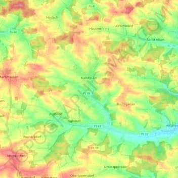
Name: Nandlstadt topographic map, elevation, terrain.
Location: Nandlstadt, Landkreis Freising, Bavaria, 85405, Germany (48.50111 11.76120 48.56388 11.86896)
Average elevation: 485 m
Minimum elevation: 440 m
Maximum elevation: 528 m
Other topographic maps
Click on a map to view its topography, its elevation and its terrain.
Zolling
Germany > Bavaria > Landkreis Freising
Zolling, Zolling (VGem), Landkreis Freising, Bavaria, 85406, Germany
Average elevation: 472 m
Freising
Germany > Bavaria > Landkreis Freising
Freising, Landkreis Freising, Bavaria, Germany
Average elevation: 457 m