
El Porvenir topographic map
Interactive map
Click on the map to display elevation.
About this map
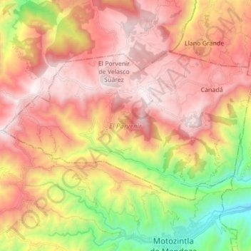
Name: El Porvenir topographic map, elevation, terrain.
Location: El Porvenir, Chiapas, Mexique (15.38957 -92.34129 15.46839 -92.20377)
Average elevation: 2,216 m
Minimum elevation: 1,123 m
Maximum elevation: 3,074 m
Other topographic maps
Click on a map to view its topography, its elevation and its terrain.