
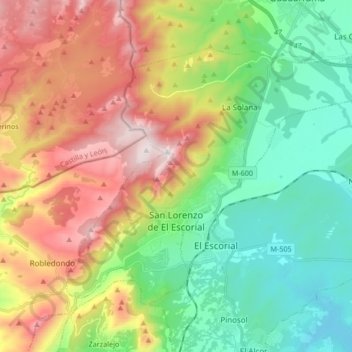
San Lorenzo de El Escorial topographic map
Interactive map
Click on the map to display elevation.
About this map
Name: San Lorenzo de El Escorial topographic map, elevation, terrain.
Average elevation: 1,179 m
Minimum elevation: 825 m
Maximum elevation: 1,754 m
Die Gemeinde liegt in der Sierra de Guadarrama in einer mittleren Höhe von 1035 Metern und ist 47 km von Madrid entfernt. Sie hat 18.369 Einwohner (Stand 1. Januar 2019).