
Weihai topographic map
Interactive map
Click on the map to display elevation.
About this map
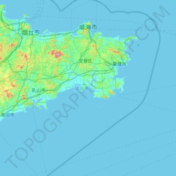
Name: Weihai topographic map, elevation, terrain.
Location: Weihai, Shandong, 264200, China (36.11121 121.17463 37.59628 122.77496)
Average elevation: 23 m
Minimum elevation: -2 m
Maximum elevation: 832 m
Other topographic maps
Click on a map to view its topography, its elevation and its terrain.