Geolocate

Les Potes topographic map

Click on the map to display elevation.

About this map

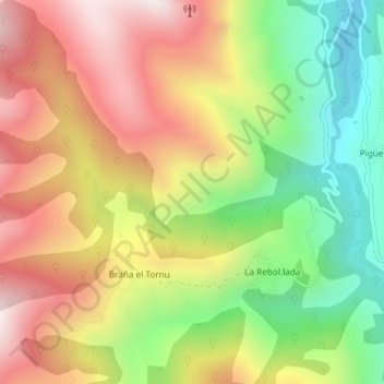
Name: Les Potes topographic map, elevation, terrain.

Location: Les Potes, Braña el Tornu, Somiedo, Asturias, 33842, Spain (43.12356 -6.35736 43.14356 -6.33736)

Average elevation: 988 m

Minimum elevation: 549 m

Maximum elevation: 1,426 m

Gear up for your next adventure:

🚲Bikepacking Frame Bags - Storage for tools and navigation gear on long off-road rides
🧦Hiking Socks - Breathable socks designed to prevent blisters on long walks
🥼Base Layers - Thermal base layers for temperature regulation
🧊Personal Water Filters - Drink safely from mountain streams marked on your map
👖Hiking Trousers - Durable trousers designed for rough terrain

As an Amazon Associate, this site earns from qualifying purchases at no extra cost to you.