
Thank you for supporting this site ❤️
Make a donation
Make a donation
Gear up for your next adventure:
As an Amazon Associate, this site earns from qualifying purchases at no extra cost to you.
Ayon topographic map
Click on the map to display elevation.
Thank you for supporting this site ❤️
Make a donation
Make a donation
Gear up for your next adventure:
As an Amazon Associate, this site earns from qualifying purchases at no extra cost to you.
About this map
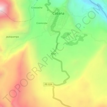
Name: Ayon topographic map, elevation, terrain.
Location: Ayon, Cabana, Lucanas, Ayacucho, Perú (-14.32362 -73.98901 -14.28362 -73.94901)
Average elevation: 3,443 m
Minimum elevation: 2,937 m
Maximum elevation: 4,023 m
Thank you for supporting this site ❤️
Make a donation
Make a donation
Gear up for your next adventure:
As an Amazon Associate, this site earns from qualifying purchases at no extra cost to you.