
Tierfed topographic map
Interactive map
Click on the map to display elevation.
About this map
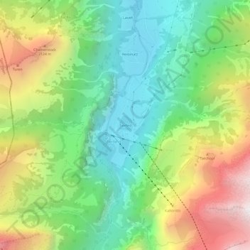
Name: Tierfed topographic map, elevation, terrain.
Location: Tierfed, Glarus Süd, Glarus, 8783, Schweiz (46.86103 8.96388 46.90103 9.00388)
Average elevation: 1,470 m
Minimum elevation: 766 m
Maximum elevation: 2,629 m