
Pout topographic map
Interactive map
Click on the map to display elevation.
About this map
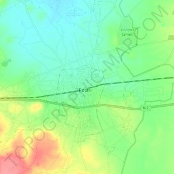
Name: Pout topographic map, elevation, terrain.
Location: Pout, Thiès, Sénégal (14.73169 -17.09943 14.81169 -17.01943)
Average elevation: 33 m
Minimum elevation: 6 m
Maximum elevation: 87 m