
Thank you for supporting this site ❤️
Make a donation
Make a donation
Gear up for your next adventure:
As an Amazon Associate, this site earns from qualifying purchases at no extra cost to you.
Trappa - Bagneri topographic map
Click on the map to display elevation.
Thank you for supporting this site ❤️
Make a donation
Make a donation
Gear up for your next adventure:
As an Amazon Associate, this site earns from qualifying purchases at no extra cost to you.
About this map
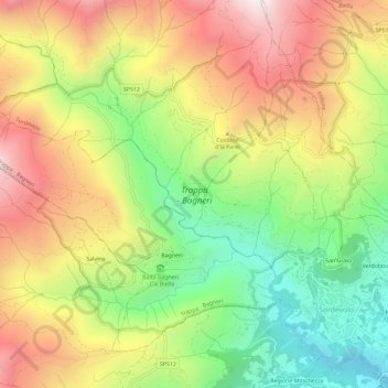
Name: Trappa - Bagneri topographic map, elevation, terrain.
Location: Trappa - Bagneri, Sordevolo, Biella, Piedmont, Italy (45.57119 7.91991 45.60018 7.97793)
Average elevation: 1,045 m
Minimum elevation: 506 m
Maximum elevation: 1,630 m
Thank you for supporting this site ❤️
Make a donation
Make a donation
Gear up for your next adventure:
As an Amazon Associate, this site earns from qualifying purchases at no extra cost to you.