
Make a donation
Gear up for your next adventure:
As an Amazon Associate, this site earns from qualifying purchases at no extra cost to you.
Waterford topographic map
Click on the map to display elevation.
Make a donation
Gear up for your next adventure:
As an Amazon Associate, this site earns from qualifying purchases at no extra cost to you.
About this map
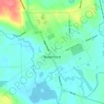
Name: Waterford topographic map, elevation, terrain.
Location: Waterford, Erie County, Pennsylvania, United States (41.93353 -79.99517 41.95395 -79.97046)
Average elevation: 371 m
Minimum elevation: 352 m
Maximum elevation: 430 m
Make a donation
Gear up for your next adventure:
As an Amazon Associate, this site earns from qualifying purchases at no extra cost to you.
Other topographic maps
Click on a map to view its topography, its elevation and its terrain.
East Springfield
United States > Pennsylvania > Erie County > Springfield Township
Average elevation: 229 m
North Springfield
United States > Pennsylvania > Erie County > Springfield Township
Average elevation: 199 m
Make a donation
Gear up for your next adventure:
As an Amazon Associate, this site earns from qualifying purchases at no extra cost to you.