
Blixterboda topographic map
Interactive map
Click on the map to display elevation.
About this map
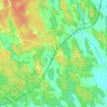
Name: Blixterboda topographic map, elevation, terrain.
Location: Blixterboda, Lindesbergs kommun, Örebro County, 718 91, Sweden (59.46739 15.41504 59.50739 15.45504)
Average elevation: 50 m
Minimum elevation: 32 m
Maximum elevation: 73 m
Other topographic maps
Click on a map to view its topography, its elevation and its terrain.