
Bojongsari topographic map
Interactive map
Click on the map to display elevation.
About this map
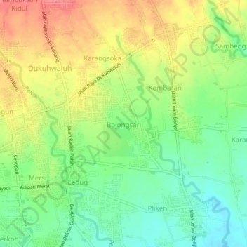
Name: Bojongsari topographic map, elevation, terrain.
Location: Bojongsari, Banyumas, Central Java, Java, 53182, Indonesia (-7.43693 109.25899 -7.39693 109.29899)
Average elevation: 79 m
Minimum elevation: 47 m
Maximum elevation: 116 m
Other topographic maps
Click on a map to view its topography, its elevation and its terrain.
Desa Banjar Anyar Kidul Kecamatan Sokaraja
Indonesia > Central Java > Banyumas
Average elevation: 43 m