Geolocate

Jü de Börz - Würzjoch - Passo delle Erbe topographic map

Interactive map

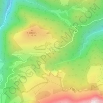
Click on the map to display elevation.

About this map

Name: Jü de Börz - Würzjoch - Passo delle Erbe topographic map, elevation, terrain.

Location: Jü de Börz - Würzjoch - Passo delle Erbe, San Martin de Tor - San Martino in Badia - St. Martin in Thurn, Pustertal - Val Pusteria, South Tyrol, Trentino-Alto Adige/Südtirol, 39030, Italy (46.67506 11.81426 46.67516 11.81436)

Average elevation: 1,934 m

Minimum elevation: 1,587 m

Maximum elevation: 2,379 m

Other topographic maps

Click on a map to view its topography, its elevation and its terrain.

San Martin de Tor - St. Martin in Thurn - San Martino in Badia

Italy > Trentino-Alto Adige/Südtirol > South Tyrol > San Martin de Tor - San Martino in Badia - St. Martin in Thurn > San Martin de Tor - St. Martin in Thurn - San Martino in Badia

San Martin de Tor - St. Martin in Thurn - San Martino in Badia, San Martin de Tor - San Martino in Badia - St. Martin in Thurn, Pustertal - Val Pusteria, South Tyrol, Trentino-Alto Adige/Südtirol, 39030, Italy

Average elevation: 1,398 m