Geolocate

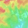
Lac Rond topographic map

Click on the map to display elevation.

About this map

Name: Lac Rond topographic map, elevation, terrain.

Location: Lac Rond, Saint-Calixte, Montcalm, Lanaudière, Québec, Canada (45.96755 -73.89862 45.97064 -73.89299)

Average elevation: 314 m

Minimum elevation: 245 m

Maximum elevation: 395 m

Other topographic maps

Click on a map to view its topography, its elevation and its terrain.

Saint-Calixte-Nord

Canada > Québec > Montcalm > Saint-Calixte

Average elevation: 335 m

Lac-Beaudry

Canada > Québec > Montcalm > Saint-Calixte

Average elevation: 333 m

Domaine-Breton

Canada > Québec > Montcalm > Saint-Calixte

Average elevation: 174 m

Gear up for your next adventure:

🛌Sleeping Bags - Warm and packable sleeping bags for outdoor nights
📷Camera Straps - Secure straps for carrying cameras while walking
📚UK Hiking Guidebooks - Detailed route descriptions for the Lake District, Peaks, and Highlands
🔦LED Camping Lanterns - Illumination for reading maps inside your tent at night
🧣Fleece Neck Warmers - Extra insulation for winter topographic surveys

As an Amazon Associate, this site earns from qualifying purchases at no extra cost to you.