
Malyovitsa topographic map
Interactive map
Click on the map to display elevation.
About this map
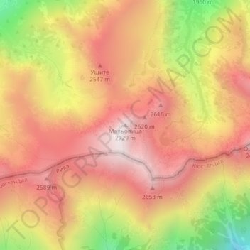
Name: Malyovitsa topographic map, elevation, terrain.
Location: Malyovitsa, Samokov, Sofia, Bulgaria (42.17377 23.36297 42.17387 23.36307)
Average elevation: 2,348 m
Minimum elevation: 1,745 m
Maximum elevation: 2,722 m
Other topographic maps
Click on a map to view its topography, its elevation and its terrain.