
Le Coudrai topographic map
Interactive map
Click on the map to display elevation.
About this map
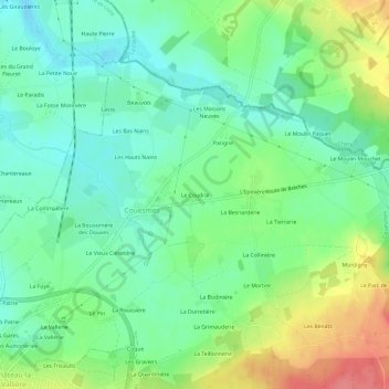
Name: Le Coudrai topographic map, elevation, terrain.
Average elevation: 83 m
Minimum elevation: 56 m
Maximum elevation: 133 m
Other topographic maps
Click on a map to view its topography, its elevation and its terrain.
La Guilbertière
France > Centre-Val de Loire > Indre-et-Loire > Couesmes
La Guilbertière, Couesmes, Chinon, Indre-et-Loire, Centre-Val de Loire, France métropolitaine, 37330, France
Average elevation: 114 m