
Чистенское сельское поселение topographic map
Interactive map
Click on the map to display elevation.
About this map
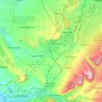
Name: Чистенское сельское поселение topographic map, elevation, terrain.
Average elevation: 281 m
Minimum elevation: 150 m
Maximum elevation: 544 m
Other topographic maps
Click on a map to view its topography, its elevation and its terrain.
Трудовское сельское поселение
Ukraine > Autonomous Republic of Crimea > Simferopol District
Average elevation: 352 m