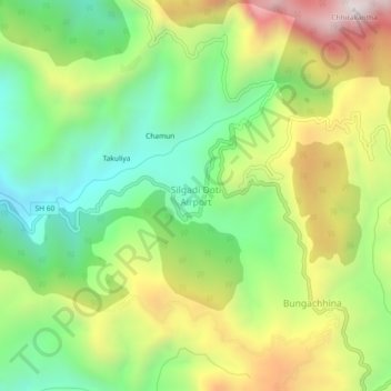
Silgadi Doti Airport topographic map
Interactive map
Click on the map to display elevation.
About this map
Name: Silgadi Doti Airport topographic map, elevation, terrain.
Average elevation: 1,358 m
Minimum elevation: 954 m
Maximum elevation: 1,944 m

Click on the map to display elevation.
Name: Silgadi Doti Airport topographic map, elevation, terrain.
Average elevation: 1,358 m
Minimum elevation: 954 m
Maximum elevation: 1,944 m