
Bukit Gambir topographic map
Interactive map
Click on the map to display elevation.
About this map
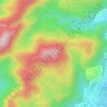
Name: Bukit Gambir topographic map, elevation, terrain.
Location: Bukit Gambir, George Town, Penang, 11020, Malaysia (5.31534 100.24852 5.31544 100.24862)
Average elevation: 206 m
Minimum elevation: 12 m
Maximum elevation: 403 m
Other topographic maps
Click on a map to view its topography, its elevation and its terrain.
Penang Hill
Malaysia > Penang > George Town > Ayer Itam
A number of hills are covered by Penang Hill, with the highest point being Western Hill that stands at an altitude of 833 meters (2,733 feet) above sea level. Penang Hill is a hilly and forested area that stands out from the lowlands of Malaysia by being hilly and wooded. The area was used as a retreat during…
Average elevation: 436 m