
Dunstable Downs topographic map
Interactive map
Click on the map to display elevation.
Dunstable Downs
Because of its elevation, Dunstable Downs hosted a station in the shutter telegraph chain which connected the Admiralty in London to its naval ships in the port of Great Yarmouth during the years 1808 to 1814.
About this map
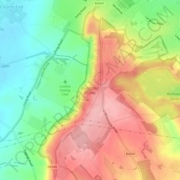
Name: Dunstable Downs topographic map, elevation, terrain.
Average elevation: 178 m
Minimum elevation: 112 m
Maximum elevation: 245 m
Central Bedfordshire trails, hiking, mountain biking, running and outdoor activities