
Alwoodley topographic map
Interactive map
Click on the map to display elevation.
About this map
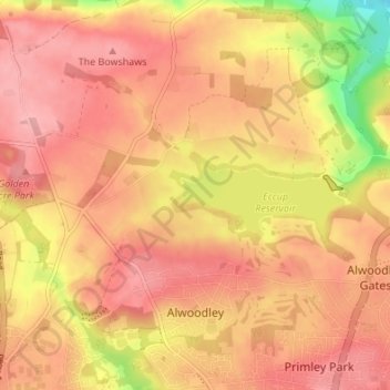
Name: Alwoodley topographic map, elevation, terrain.
Location: Alwoodley, Leeds, West Yorkshire, England, United Kingdom (53.85091 -1.58938 53.89081 -1.52594)
Average elevation: 134 m
Minimum elevation: 55 m
Maximum elevation: 171 m
England trails, hiking, mountain biking, running and outdoor activities
Other topographic maps
Click on a map to view its topography, its elevation and its terrain.