
La Maletière topographic map
Interactive map
Click on the map to display elevation.
About this map
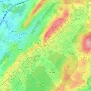
Name: La Maletière topographic map, elevation, terrain.
Average elevation: 288 m
Minimum elevation: 224 m
Maximum elevation: 368 m
Other topographic maps
Click on a map to view its topography, its elevation and its terrain.
La Perrouse
France > Bourgogne-Franche-Comté > Doubs > Pouilley-les-Vignes
La Perrouse, Pouilley-les-Vignes, Besançon, Doubs, Bourgogne-Franche-Comté, France métropolitaine, 25115, France
Average elevation: 266 m