
Karl topographic map
Interactive map
Click on the map to display elevation.
About this map
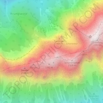
Name: Karl topographic map, elevation, terrain.
Location: Karl, Bad Mitterndorf, Bezirk Liezen, Styria, 8983, Austria (47.51656 13.99836 47.51870 14.00024)
Average elevation: 1,635 m
Minimum elevation: 1,018 m
Maximum elevation: 2,338 m
Other topographic maps
Click on a map to view its topography, its elevation and its terrain.
Rödschitz
Austria > Styria > Bezirk Liezen > Bad Mitterndorf > Rödschitz
Rödschitz, Bad Mitterndorf, Bezirk Liezen, Styria, 8983, Austria
Average elevation: 876 m