Geolocate

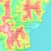
Mutukula topographic map

Click on the map to display elevation.

Mutukula

The town of Mutukula is a border town between Uganda and Tanzania. At an altitude of 1,190 metres (3,900 ft), above sea level, Mutukula is an important border post and major crossing point, for both human and commercial traffic. In February 2016, the border post between both countries merged operations on both sides. Vehicles and passengers clear customs and immigration once, in the country they are entering, with officials from both countries present.

Wikipedia (CC-BY-SA 3.0)

About this map

Name: Mutukula topographic map, elevation, terrain.

Location: Mutukula, Missenyi, Kagera, Lake Zone, Tanzania (-1.02068 31.39566 -0.98068 31.43566)

Average elevation: 1,181 m

Minimum elevation: 1,158 m

Maximum elevation: 1,349 m

Other topographic maps

Click on a map to view its topography, its elevation and its terrain.

Karagwe

Tanzania > Kagera

Average elevation: 1,354 m

Bukoba

Tanzania > Kagera

Average elevation: 1,216 m

Kibeta

Tanzania > Kagera

Average elevation: 1,261 m

Muleba

Tanzania > Kagera

Average elevation: 1,256 m

Karagwe

Tanzania > Kagera

Average elevation: 1,354 m

Karagwe

Tanzania > Kagera

Average elevation: 1,354 m

Gear up for your next adventure:

🖼️Topographic Map Art - Decorative 3D-effect posters of famous UK peaks and regions
🥾Hiking Boot Waterproofing Wax - Maintain the lifespan of your leather trekking boots
👕Merino Base Layers - Natural temperature regulation for cold weather hiking and camping
📸Action Camera Chest Mounts - Record your ascent following topographic paths hands-free
🎒Hiking Backpacks - Comfortable backpacks for day hikes and multi-day treks

As an Amazon Associate, this site earns from qualifying purchases at no extra cost to you.