
Thank you for supporting this site ❤️
Make a donation
Make a donation
Gear up for your next adventure:
As an Amazon Associate, this site earns from qualifying purchases at no extra cost to you.
Outeiro topographic map
Click on the map to display elevation.
Thank you for supporting this site ❤️
Make a donation
Make a donation
Gear up for your next adventure:
As an Amazon Associate, this site earns from qualifying purchases at no extra cost to you.
About this map
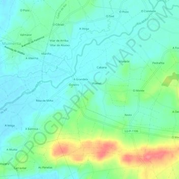
Name: Outeiro topographic map, elevation, terrain.
Location: Outeiro, Castro de Rei, Terra Chá, Lugo, Galicia, 27256, Spain (43.22412 -7.42807 43.26412 -7.38807)
Average elevation: 428 m
Minimum elevation: 407 m
Maximum elevation: 484 m
Thank you for supporting this site ❤️
Make a donation
Make a donation
Gear up for your next adventure:
As an Amazon Associate, this site earns from qualifying purchases at no extra cost to you.