Geolocate

Remus topographic map

Click on the map to display elevation.

About this map

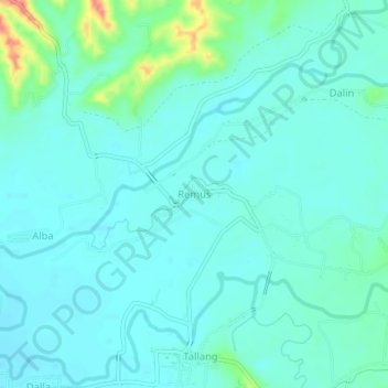
Name: Remus topographic map, elevation, terrain.

Location: Remus, Baggao, Cagayan, Cagayan Valley, Philippines (17.95439 121.88750 17.99439 121.92750)

Average elevation: 47 m

Minimum elevation: 33 m

Maximum elevation: 108 m

Gear up for your next adventure:

🗺️Scratch-off Peak Maps - Track your progress climbing Munros or Wainwrights
👟Heavy Duty Boot Laces - Always carry a spare for your hiking footwear
🧭Emergency Beacons - Safety beacons for remote outdoor locations
🔦Keychain LED Torches - Emergency backup light for finding gear in your pack
📢Survival Whistles - Essential safety gear for signaling for help in mountain fog

As an Amazon Associate, this site earns from qualifying purchases at no extra cost to you.