
Thank you for supporting this site ❤️
Make a donation
Make a donation
Gear up for your next adventure:
As an Amazon Associate, this site earns from qualifying purchases at no extra cost to you.
Huanchay topographic map
Click on the map to display elevation.
Thank you for supporting this site ❤️
Make a donation
Make a donation
Gear up for your next adventure:
As an Amazon Associate, this site earns from qualifying purchases at no extra cost to you.
About this map
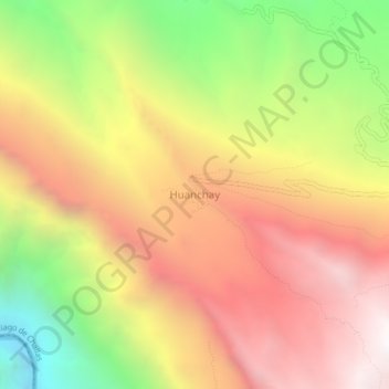
Name: Huanchay topographic map, elevation, terrain.
Location: Huanchay, Santiago de Challas, Pataz, La Libertad, Perú (-8.44565 -77.40801 -8.40565 -77.36801)
Average elevation: 2,847 m
Minimum elevation: 1,670 m
Maximum elevation: 3,813 m
Thank you for supporting this site ❤️
Make a donation
Make a donation
Gear up for your next adventure:
As an Amazon Associate, this site earns from qualifying purchases at no extra cost to you.