
Postectitla topographic map
Interactive map
Click on the map to display elevation.
About this map
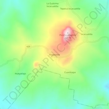
Name: Postectitla topographic map, elevation, terrain.
Location: Postectitla, Chicontepec, Veracruz, Mexique (20.88056 -98.05583 20.92056 -98.01583)
Average elevation: 418 m
Minimum elevation: 256 m
Maximum elevation: 709 m