
Thank you for supporting this site ❤️
Make a donation
Make a donation
Gear up for your next adventure:
As an Amazon Associate, this site earns from qualifying purchases at no extra cost to you.
Kcauri topographic map
Click on the map to display elevation.
Thank you for supporting this site ❤️
Make a donation
Make a donation
Gear up for your next adventure:
As an Amazon Associate, this site earns from qualifying purchases at no extra cost to you.
About this map
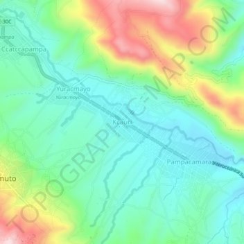
Name: Kcauri topographic map, elevation, terrain.
Location: Kcauri, Ccatca, Quispicanchi, Cusco, Perú (-13.65472 -71.54860 -13.61472 -71.50860)
Average elevation: 3,708 m
Minimum elevation: 3,593 m
Maximum elevation: 3,963 m
Thank you for supporting this site ❤️
Make a donation
Make a donation
Gear up for your next adventure:
As an Amazon Associate, this site earns from qualifying purchases at no extra cost to you.