Geolocate

Wonocolo topographic map

Click on the map to display elevation.

About this map

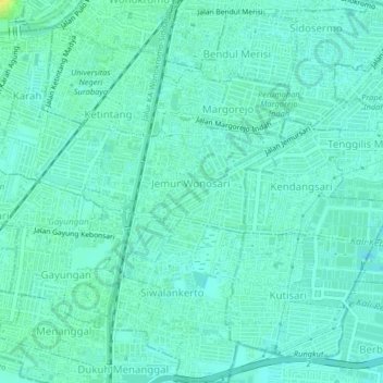
Name: Wonocolo topographic map, elevation, terrain.

Location: Wonocolo, Surabaya, East Java, Java, Indonesia (-7.34518 112.72932 -7.30481 112.75938)

Average elevation: 6 m

Minimum elevation: -3 m

Maximum elevation: 24 m

Other topographic maps

Click on a map to view its topography, its elevation and its terrain.

Asemrowo

Indonesia > East Java > Surabaya

Average elevation: 4 m

Taman Prestasi

Indonesia > East Java > Surabaya > Ketabang

Average elevation: 6 m

Dukuh Pakis

Indonesia > East Java > Surabaya

Average elevation: 9 m

Dukuh Pakis

Indonesia > East Java > Surabaya

Average elevation: 15 m

Gear up for your next adventure:

🌄Outdoor Binoculars - Compact binoculars for landscape observation
📸Action Camera Chest Mounts - Record your ascent following topographic paths hands-free
💧Hydration Reservoirs - Convenient water bladders for hands-free drinking on the move
🔭Compact Hiking Binoculars - Lightweight optics for scouting terrain and spotting wildlife
🥾Walking Shoes - Lightweight walking shoes for countryside and coastal paths

As an Amazon Associate, this site earns from qualifying purchases at no extra cost to you.