Geolocate

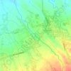
Petok topographic map

Click on the map to display elevation.

About this map

Name: Petok topographic map, elevation, terrain.

Location: Petok, Mojo, Kediri Regency, East Java, Java, 64171, Indonesia (-7.87696 111.96802 -7.83696 112.00802)

Average elevation: 78 m

Minimum elevation: 64 m

Maximum elevation: 119 m

Other topographic maps

Click on a map to view its topography, its elevation and its terrain.

Ngasem

Indonesia > East Java > Kediri Regency

Average elevation: 76 m

Purwoasri

Indonesia > East Java > Kediri Regency

Average elevation: 51 m

Banyakan

Indonesia > East Java > Kediri Regency

Average elevation: 319 m

Gampengrejo

Indonesia > East Java > Kediri Regency

Average elevation: 63 m

Kunjang

Indonesia > East Java > Kediri Regency

Average elevation: 68 m

Mojo

Indonesia > East Java > Kediri Regency

Average elevation: 368 m

Semen

Indonesia > East Java > Kediri Regency

Average elevation: 557 m

Kali Konto

Indonesia > East Java > Kediri Regency > Kandangan

Average elevation: 171 m

Kepung

Indonesia > East Java > Kediri Regency

Average elevation: 499 m

Plemahan

Indonesia > East Java > Kediri Regency

Average elevation: 82 m

Puncu

Indonesia > East Java > Kediri Regency

Average elevation: 409 m

Badas

Indonesia > East Java > Kediri Regency

Average elevation: 110 m

Tarokan

Indonesia > East Java > Kediri Regency

Average elevation: 105 m

Gear up for your next adventure:

🧤Thermal Touchscreen Gloves - Stay warm while operating your GPS or smartphone camera
🎒Backpack Rain Covers - Universal waterproof covers to protect your gear from downpours
🥤Hiking Water Bottles - Reusable bottles for hydration on the trail
❄️Walking Crampons - Added traction for icy slopes and winter peak bagging
🛌Insulated Sleeping Mats - Crucial thermal protection when sleeping on cold, uneven ground

As an Amazon Associate, this site earns from qualifying purchases at no extra cost to you.