
Thank you for supporting this site ❤️
Make a donation
Make a donation
Gear up for your next adventure:
As an Amazon Associate, this site earns from qualifying purchases at no extra cost to you.
Ccaccaccollo topographic map
Click on the map to display elevation.
Thank you for supporting this site ❤️
Make a donation
Make a donation
Gear up for your next adventure:
As an Amazon Associate, this site earns from qualifying purchases at no extra cost to you.
About this map
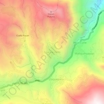
Name: Ccaccaccollo topographic map, elevation, terrain.
Location: Ccaccaccollo, Taray, Province of Calca, Cusco, Peru (-13.47524 -71.90788 -13.43524 -71.86788)
Average elevation: 3,719 m
Minimum elevation: 3,020 m
Maximum elevation: 4,289 m
Thank you for supporting this site ❤️
Make a donation
Make a donation
Gear up for your next adventure:
As an Amazon Associate, this site earns from qualifying purchases at no extra cost to you.