
Llahuar topographic map
Interactive map
Click on the map to display elevation.
About this map
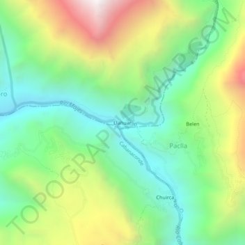
Name: Llahuar topographic map, elevation, terrain.
Location: Llahuar, Castilla, Arequipa, Peru (-15.60142 -72.02929 -15.56142 -71.98929)
Average elevation: 2,574 m
Minimum elevation: 2,013 m
Maximum elevation: 3,564 m