
Seth topographic map
Interactive map
Click on the map to display elevation.
About this map
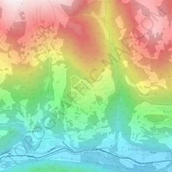
Name: Seth topographic map, elevation, terrain.
Location: Seth, Surselva, Graubünden, 7157, Schweiz (46.77124 9.14351 46.81124 9.18351)
Average elevation: 1,283 m
Minimum elevation: 701 m
Maximum elevation: 2,048 m