Geolocate

Konia topographic map

Click on the map to display elevation.

About this map

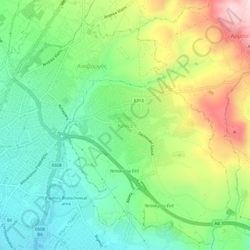
Name: Konia topographic map, elevation, terrain.

Location: Konia, Paphos District, Cyprus, 8300, Cyprus (34.76494 32.43756 34.80494 32.47756)

Average elevation: 190 m

Minimum elevation: 59 m

Maximum elevation: 420 m

Gear up for your next adventure:

🛌Sleeping Bags - Warm and packable sleeping bags for outdoor nights
🔋Rechargeable Batteries - Eco-friendly power for headlamps and older GPS units
📍Handheld GPS Navigators - Reliable satellite navigation for hiking and off-road exploration
🧊Personal Water Filters - Drink safely from mountain streams marked on your map
🥾Hiking Boot Waterproofing Wax - Maintain the lifespan of your leather trekking boots

As an Amazon Associate, this site earns from qualifying purchases at no extra cost to you.