
Haridwar topographic map
Interactive map
Click on the map to display elevation.
About this map
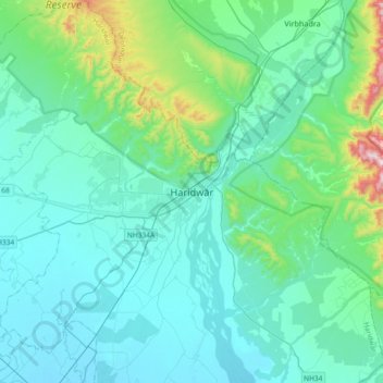
Name: Haridwar topographic map, elevation, terrain.
Location: Haridwar, Hardwar, Haridwar, Uttarakhand, 249401, India (29.77845 77.98530 30.09845 78.30530)
Average elevation: 360 m
Minimum elevation: 240 m
Maximum elevation: 1,093 m