
El Asnam topographic map
Interactive map
Click on the map to display elevation.
About this map
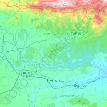
Name: El Asnam topographic map, elevation, terrain.
Location: El Asnam, Bechloul District, Bouira, 10022, Algeria (36.27236 3.93072 36.46903 4.13640)
Average elevation: 705 m
Minimum elevation: 375 m
Maximum elevation: 2,137 m
Other topographic maps
Click on a map to view its topography, its elevation and its terrain.