
el Trull topographic map
Interactive map
Click on the map to display elevation.
About this map
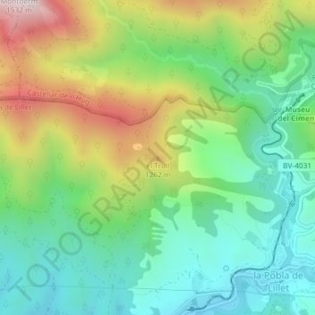
Name: el Trull topographic map, elevation, terrain.
Location: el Trull, la Pobla de Lillet, Berguedà, BCN, Catalonia, Spain (42.25426 1.96091 42.25436 1.96101)
Average elevation: 1,063 m
Minimum elevation: 828 m
Maximum elevation: 1,497 m