
Thank you for supporting this site ❤️
Make a donation
Make a donation
Gear up for your next adventure:
As an Amazon Associate, this site earns from qualifying purchases at no extra cost to you.
Hartenstein topographic map
Click on the map to display elevation.
Thank you for supporting this site ❤️
Make a donation
Make a donation
Gear up for your next adventure:
As an Amazon Associate, this site earns from qualifying purchases at no extra cost to you.
About this map
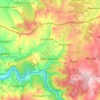
Name: Hartenstein topographic map, elevation, terrain.
Location: Hartenstein, Langenweißbach, Zwickau, Saxony, 08134, Germany (50.62835 12.62610 50.70991 12.71870)
Average elevation: 430 m
Minimum elevation: 292 m
Maximum elevation: 573 m
Thank you for supporting this site ❤️
Make a donation
Make a donation
Gear up for your next adventure:
As an Amazon Associate, this site earns from qualifying purchases at no extra cost to you.