
Schochen topographic map
Interactive map
Click on the map to display elevation.
About this map
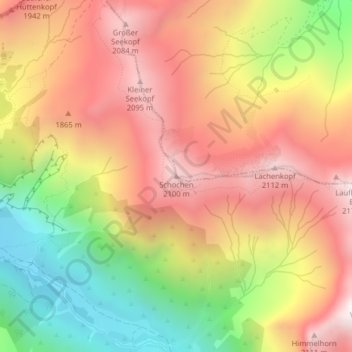
Name: Schochen topographic map, elevation, terrain.
Average elevation: 1,643 m
Minimum elevation: 1,019 m
Maximum elevation: 2,147 m
Die Schartenhöhe des Schochens beträgt mindestens 60 Meter, seine Dominanz 800 Meter, wobei jeweils der Lachenkopf Referenzberg ist.
Other topographic maps
Click on a map to view its topography, its elevation and its terrain.
Weidach
Deutschland > Bayern > Landkreis Oberallgäu > Oberstdorf > Tiefenbach
Weidach, Tiefenbach, Oberstdorf, Landkreis Oberallgäu, Bayern, 87561, Deutschland
Average elevation: 979 m