Geolocate

Lamoni topographic map

Click on the map to display elevation.

About this map
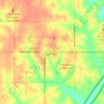
Name: Lamoni topographic map, elevation, terrain.

Location: Lamoni, Decatur County, Iowa, 50140, United States (40.60912 -93.95793 40.63816 -93.89246)

Average elevation: 341 m

Minimum elevation: 314 m

Maximum elevation: 357 m

Gear up for your next adventure:

🪢Paracord - Multi-purpose cord for camping and survival
🥾Hiking Boots - Waterproof and durable boots for long-distance hiking in the UK
🥼Base Layers - Thermal base layers for temperature regulation
🔭Compact Hiking Binoculars - Lightweight optics for scouting terrain and spotting wildlife
🧼Biodegradable Soap - Leave-no-trace hygiene for multi-day mountain treks

As an Amazon Associate, this site earns from qualifying purchases at no extra cost to you.