
Lhayü topographic map
Interactive map
Click on the map to display elevation.
About this map
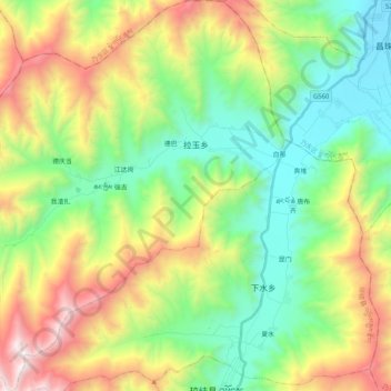
Name: Lhayü topographic map, elevation, terrain.
Location: Lhayü, Chongye County, Lhoka, Tibet, China (29.03309 91.51313 29.21342 91.71699)
Average elevation: 4,196 m
Minimum elevation: 3,569 m
Maximum elevation: 5,346 m